
Dant topographic map
Interactive map
Click on the map to display elevation.
About this map
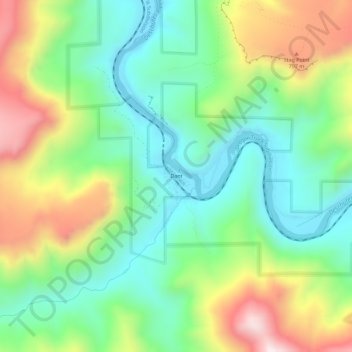
Name: Dant topographic map, elevation, terrain.
Location: Dant, Wasco County, Oregon, United States (45.01794 -121.13255 45.05794 -121.09255)
Average elevation: 536 m
Minimum elevation: 292 m
Maximum elevation: 971 m
Other topographic maps
Click on a map to view its topography, its elevation and its terrain.
Pine Grove
United States > Oregon > Wasco County
Pine Grove, Wasco County, Oregon, United States
Average elevation: 713 m
The Dalles
United States > Oregon > Wasco County
The Dalles, Wasco County, Oregon, United States
Average elevation: 105 m
Mosier
United States > Oregon > Wasco County
Mosier, Wasco County, Oregon, United States
Average elevation: 74 m
Tygh Valley
United States > Oregon > Wasco County > Tygh Valley
Tygh Valley, Wasco County, Oregon, United States
Average elevation: 397 m
Maupin
United States > Oregon > Wasco County
Maupin, Wasco County, Oregon, United States
Average elevation: 368 m
Shaniko
United States > Oregon > Wasco County > Shaniko
Shaniko, Wasco County, Oregon, United States
Average elevation: 1,009 m
Frog Lake
United States > Oregon > Wasco County
Frog Lake, Wasco County, Oregon, United States
Average elevation: 1,266 m