
Thank you for supporting this site ❤️
Make a donation
Make a donation
Hohensaas topographic map
Click on the map to display elevation.
Thank you for supporting this site ❤️
Make a donation
Make a donation
About this map
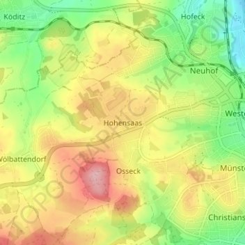
Name: Hohensaas topographic map, elevation, terrain.
Location: Hohensaas, Hof, Bayern, 95030, Deutschland (50.29356 11.85657 50.33356 11.89657)
Average elevation: 544 m
Minimum elevation: 469 m
Maximum elevation: 627 m
Thank you for supporting this site ❤️
Make a donation
Make a donation
Other topographic maps
Click on a map to view its topography, its elevation and its terrain.