
Thank you for supporting this site ❤️
Make a donation
Make a donation
Saale topographic map
Click on the map to display elevation.
Thank you for supporting this site ❤️
Make a donation
Make a donation
About this map
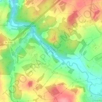
Name: Saale topographic map, elevation, terrain.
Location: Saale, Unterkotzau, Hof, Bayern, 95030, Deutschland (50.34689 11.87397 50.35049 11.87994)
Average elevation: 505 m
Minimum elevation: 457 m
Maximum elevation: 557 m
Thank you for supporting this site ❤️
Make a donation
Make a donation
Other topographic maps
Click on a map to view its topography, its elevation and its terrain.