
制锦市街道 topographic map
Interactive map
Click on the map to display elevation.
About this map
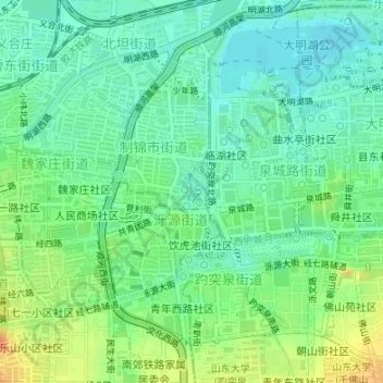
Name: 制锦市街道 topographic map, elevation, terrain.
Location: 制锦市街道, 天桥区, 济南市, 山东省, 250000, 中国, 五龙潭 (36.66479 117.00834 36.66548 117.00892)
Average elevation: 37 m
Minimum elevation: 21 m
Maximum elevation: 64 m
Other topographic maps
Click on a map to view its topography, its elevation and its terrain.