
峨眉山市 topographic map
Interactive map
Click on the map to display elevation.
About this map
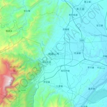
Name: 峨眉山市 topographic map, elevation, terrain.
Location: 峨眉山市, 乐山市, 四川省, 614200, 中国 (29.44173 103.32222 29.76173 103.64222)
Average elevation: 726 m
Minimum elevation: 370 m
Maximum elevation: 3,083 m
Other topographic maps
Click on a map to view its topography, its elevation and its terrain.