
Make a donation
Kiewit topographic map
Click on the map to display elevation.
Make a donation
Kiewit
Kiewit ligt in de Kempen op ongeveer 45 meter hoogte. De plaats ligt in een heide-ontginning. De noordelijke grens wordt gevormd door de Slangbeek.
Make a donation
About this map
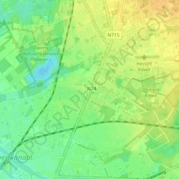
Name: Kiewit topographic map, elevation, terrain.
Location: Kiewit, Hasselt, Limburg, 3520, België (50.94317 5.33489 50.98317 5.37489)
Average elevation: 37 m
Minimum elevation: 24 m
Maximum elevation: 48 m
Make a donation
Other topographic maps
Click on a map to view its topography, its elevation and its terrain.
Albertkanaal
België > Limburg > Hasselt > Hasselt
Om het hoofd te bieden aan deze groei werd in 1968 besloten het kanaal te moderniseren. Het werd verbreed tot 100 m (behalve onder de bruggen) en de nieuwe randen werden versterkt. Om duwvaart (4 barges ofwel 9.000 ton) mogelijk te maken kreeg elk sluizencomplex een duwvaartsluis. In 1994 werd de duwvaartsluis…
Average elevation: 75 m
Make a donation
Hasselt
België > Limburg > Hasselt > Hasselt
Hasselt ligt op de grens tussen de Kempen ten noorden van de stad en Vochtig-Haspengouw ten zuiden. Die grens wordt gevormd door de Demer, de belangrijkste waterloop die iets ten noorden van de stadskern in noordwestelijke richting stroomt. De hoogte boven de zeespiegel stijgt op het grondgebied van 24 meter…
Average elevation: 39 m
Make a donation
Make a donation