
翠屏街道 topographic map
Interactive map
Click on the map to display elevation.
About this map
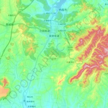
Name: 翠屏街道 topographic map, elevation, terrain.
Location: 翠屏街道, 栖霞市, 烟台市, 山东省, 265300, 中国 (37.23457 120.75046 37.31400 120.93647)
Average elevation: 220 m
Minimum elevation: 108 m
Maximum elevation: 513 m
Other topographic maps
Click on a map to view its topography, its elevation and its terrain.