
Mississipi topographic map
Interactive map
Click on the map to display elevation.
About this map
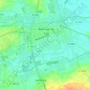
Name: Mississipi topographic map, elevation, terrain.
Average elevation: 24 m
Minimum elevation: 15 m
Maximum elevation: 46 m
Other topographic maps
Click on a map to view its topography, its elevation and its terrain.
Pecqueur
France > Hauts-de-France > Pas-de-Calais > Aire-sur-la-Lys
Pecqueur, Aire-sur-la-Lys, Saint-Omer, Pas-de-Calais, Hauts-de-France, France métropolitaine, 62120, France
Average elevation: 20 m
Moulin-le-Comte
France > Hauts-de-France > Pas-de-Calais > Aire-sur-la-Lys
Moulin-le-Comte, Aire-sur-la-Lys, Saint-Omer, Pas-de-Calais, Hauts-de-France, France métropolitaine, 62120, France
Average elevation: 27 m