
Thank you for supporting this site ❤️
Make a donation
Make a donation
Moulin-le-Comte topographic map
Click on the map to display elevation.
Thank you for supporting this site ❤️
Make a donation
Make a donation
About this map
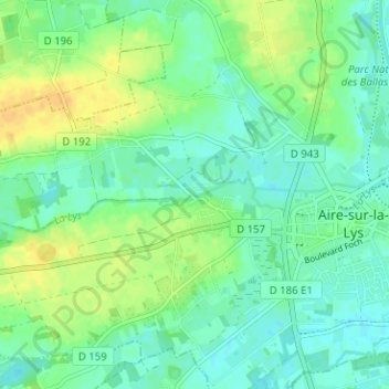
Name: Moulin-le-Comte topographic map, elevation, terrain.
Average elevation: 27 m
Minimum elevation: 17 m
Maximum elevation: 42 m
Thank you for supporting this site ❤️
Make a donation
Make a donation
Other topographic maps
Click on a map to view its topography, its elevation and its terrain.
62120
France > Hauts-de-France > Pas-de-Calais > Aire-sur-la-Lys > Moulin-le-Comte
Average elevation: 46 m