
井坡镇 topographic map
Interactive map
Click on the map to display elevation.
About this map
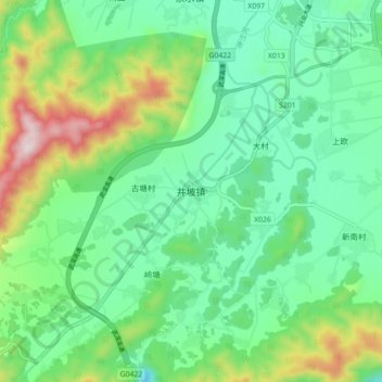
Name: 井坡镇 topographic map, elevation, terrain.
Location: 井坡镇, 汝城县, 郴州市, 湖南省, 中国 (25.40510 113.60400 25.48510 113.68400)
Average elevation: 690 m
Minimum elevation: 526 m
Maximum elevation: 1,093 m
Other topographic maps
Click on a map to view its topography, its elevation and its terrain.