
Nene topographic map
Interactive map
Click on the map to display elevation.
About this map
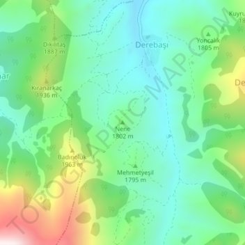
Name: Nene topographic map, elevation, terrain.
Location: Nene, Develi, Kayseri, Central Anatolia Region, Turkey (38.13654 35.93961 38.13664 35.93971)
Average elevation: 1,804 m
Minimum elevation: 1,601 m
Maximum elevation: 2,279 m
Other topographic maps
Click on a map to view its topography, its elevation and its terrain.