
蓝旗镇 topographic map
Interactive map
Click on the map to display elevation.
About this map
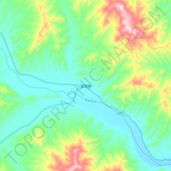
Name: 蓝旗镇 topographic map, elevation, terrain.
Location: 蓝旗镇, 承德市, 河北省, 中国 (41.31851 117.60421 41.39851 117.68421)
Average elevation: 709 m
Minimum elevation: 551 m
Maximum elevation: 1,084 m
Other topographic maps
Click on a map to view its topography, its elevation and its terrain.