
新集镇 topographic map
Interactive map
Click on the map to display elevation.
About this map
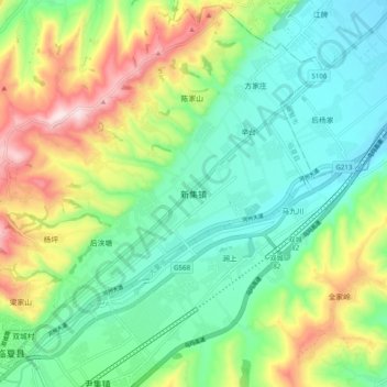
Name: 新集镇 topographic map, elevation, terrain.
Location: 新集镇, 临夏县, 临夏回族自治州, 甘肃省, 中国 (35.47162 103.04496 35.55162 103.12496)
Average elevation: 2,110 m
Minimum elevation: 1,961 m
Maximum elevation: 2,418 m
Other topographic maps
Click on a map to view its topography, its elevation and its terrain.