
Pearl Island topographic map
Interactive map
Click on the map to display elevation.
About this map
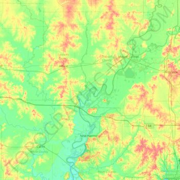
Name: Pearl Island topographic map, elevation, terrain.
Location: Pearl Island, Gibson County, Indiana, USA (37.97088 -88.25503 38.61088 -87.61503)
Average elevation: 130 m
Minimum elevation: 105 m
Maximum elevation: 184 m
Other topographic maps
Click on a map to view its topography, its elevation and its terrain.
Middle Fork of Wildcat Creek
Middle Fork of Wildcat Creek, Clinton County, Indiana, 46065, USA
Average elevation: 215 m
Mount Etna
USA > Indiana > Mount Etna
Mount Etna, Huntington County, Indiana, USA
Average elevation: 245 m