
绥阳 topographic map
Interactive map
Click on the map to display elevation.
About this map
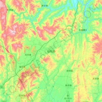
Name: 绥阳 topographic map, elevation, terrain.
Location: 绥阳, 绥阳县, 贵州省, 中国 (27.78991 107.02693 28.10991 107.34693)
Average elevation: 986 m
Minimum elevation: 663 m
Maximum elevation: 1,561 m
Other topographic maps
Click on a map to view its topography, its elevation and its terrain.