
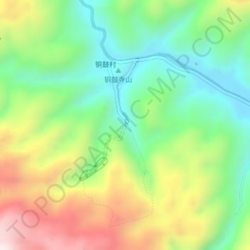
双河水洞 topographic map
Interactive map
Click on the map to display elevation.
About this map
Name: 双河水洞 topographic map, elevation, terrain.
Location: 双河水洞, 地下裂缝, 绥阳县, 遵义市, 贵州省, 中国 (28.24340 107.27493 28.24350 107.27503)
Average elevation: 921 m
Minimum elevation: 683 m
Maximum elevation: 1,290 m