
麻阳县 topographic map
Interactive map
Click on the map to display elevation.
About this map
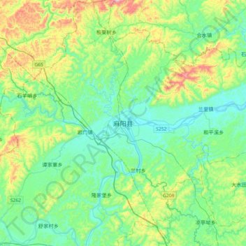
Name: 麻阳县 topographic map, elevation, terrain.
Location: 麻阳县, 麻阳苗族自治县, 怀化市, 湖南省, 中国 (27.70887 109.63806 28.02887 109.95806)
Average elevation: 288 m
Minimum elevation: 132 m
Maximum elevation: 768 m
Other topographic maps
Click on a map to view its topography, its elevation and its terrain.