
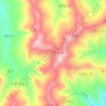
郭集村 topographic map
Interactive map
Click on the map to display elevation.
About this map
Name: 郭集村 topographic map, elevation, terrain.
Location: 郭集村, 王铺镇, 秦安县, 天水市, 甘肃省, 中国 (35.02288 105.38416 35.03046 105.39264)
Average elevation: 1,885 m
Minimum elevation: 1,729 m
Maximum elevation: 2,005 m
Other topographic maps
Click on a map to view its topography, its elevation and its terrain.