
大阳台 topographic map
Interactive map
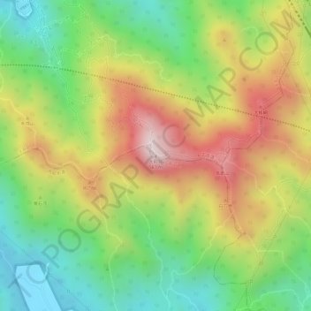
Click on the map to display elevation.
About this map
Name: 大阳台 topographic map, elevation, terrain.
Location: 大阳台, 深圳市, 广东省, 518110, 中国 (22.65439 113.95590 22.65449 113.95600)
Average elevation: 287 m
Minimum elevation: 45 m
Maximum elevation: 557 m
主峰海拔581.7米,为深圳市西部的最高點。登临大羊台山峰顶,可环视石岩街道、西丽镇、龙华区、宝安新城等,周边湖光山色,深林茂密,远处城市宏伟壮观,马路纵横交错,风景如画。
Other topographic maps
Click on a map to view its topography, its elevation and its terrain.