
Make a donation
Aksaray topographic map
Click on the map to display elevation.
Make a donation
Aksaray
Aksaray (pronounced , Koine Greek: Ἀρχελαΐς, Medieval Greek: Κολώνεια) is a city in the Central Anatolia region of Turkey and the capital district of Aksaray Province. According to 2009 census figures, the population of the province is 376 907 of which 171,423 live in the city of Aksaray. The district covers an area of 4,589 km2 (1,772 sq mi), and the average elevation is 980 m (3,215 ft), with the highest point being Mt. Hasan at 3,253 m (10,673 ft).
Make a donation
About this map
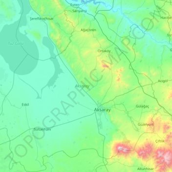
Name: Aksaray topographic map, elevation, terrain.
Location: Aksaray, Central Anatolia Region, Turkey (37.97991 33.17463 39.05093 34.50061)
Average elevation: 1,120 m
Minimum elevation: 842 m
Maximum elevation: 3,203 m
Make a donation
Other topographic maps
Click on a map to view its topography, its elevation and its terrain.
Make a donation
Make a donation
Make a donation
Gaziantep
The plan introduced several important changes to the city's transportation network. One of the most important was the addition of a rail line to connect Gaziantep to the national rail system. Up to now, Turkish railway construction had ignored Gaziantep (partly because of its mountainous surroundings); a…
Average elevation: 880 m
Make a donation
Make a donation
Make a donation
Make a donation
Make a donation
Make a donation
Make a donation
Make a donation
Make a donation
Make a donation
Mount Erciyes
The climate of the region is influenced by topography, with the Taurus and Kaçkar Mountains blocking the entry of moisture into Anatolia. Summers are dry and hot and winters wet and cold; in Kayseri, summer temperatures are about 19 °C (66 °F) and winter temperature about 0 °C (32 °F). Precipitation at…
Average elevation: 3,329 m
Make a donation
Make a donation
Make a donation
Denizli
Turkey > Denizli > Merkezefendi
Denizli is an industrial city in the southwestern part of Turkey and the eastern end of the alluvial valley formed by the river Büyük Menderes, where the plain reaches an elevation of about three hundred and fifty metres (1,148 ft). Denizli is located in the country's Aegean Region.
Average elevation: 758 m
Make a donation
Make a donation
Make a donation
Mount Ararat
Mount Ararat (/ˈærəræt/ ARR-ə-rat; Turkish: Ağrı Dağı; Armenian: Մասիս, romanized: Masis, and Արարատ, Ararat; Kurdish: Çiyayê Agirî) is a snow-capped and dormant compound volcano in the extreme east of Turkey. It consists of two major volcanic cones: Greater Ararat and Little Ararat.…
Average elevation: 4,582 m
Trabzon
Trabzon has a climate typical of the Black Sea region with plentiful precipitation. Under the Köppen climate classification, it has a humid subtropical climate (Köppen: Cfa) Summers are warm and humid, and the average maximum temperature is around 26.7 °C (80 °F) in August. Winters are cool and damp, and…
Average elevation: 241 m
Make a donation
Make a donation
Karabük
Karabük is a town and the capital district of Karabük Province in the Black Sea region of Turkey. According to the 2009 census, population of the city is 108 167. The district covers an area of 760 km2 (293 sq mi), and the town lies at an elevation of 354 m (1,161 ft).
Average elevation: 864 m
Make a donation
Make a donation
Make a donation
Make a donation