
Arslanbey topographic map
Interactive map
Click on the map to display elevation.
About this map
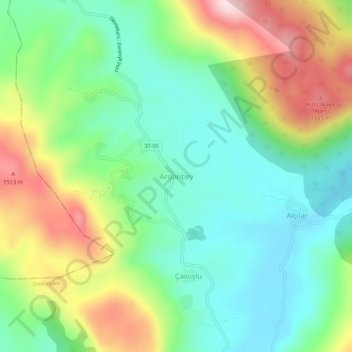
Name: Arslanbey topographic map, elevation, terrain.
Location: Arslanbey, Devrekani, Kastamonu, Black Sea Region, Turkey (41.74730 33.85249 41.78730 33.89249)
Average elevation: 1,316 m
Minimum elevation: 1,186 m
Maximum elevation: 1,555 m
Other topographic maps
Click on a map to view its topography, its elevation and its terrain.