
Kokernag Tehsil topographic map
Interactive map
Click on the map to display elevation.
About this map
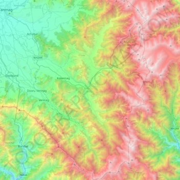
Name: Kokernag Tehsil topographic map, elevation, terrain.
Average elevation: 2,646 m
Minimum elevation: 1,462 m
Maximum elevation: 4,440 m
Other topographic maps
Click on a map to view its topography, its elevation and its terrain.
Kathua
India > Jammu and Kashmir > Kathua
Kathua is located at 32°22′N 75°31′E / 32.37°N 75.52°E / 32.37; 75.52. It has an average elevation of 393 metres (1,289 ft). The city is surrounded by three rivers. Ravi is 7 km (4.3 mi) down Kathua while Ujjh is about 11 km (6.8 mi) ahead on Jammu Highway. Kathua itself is situated along the…
Average elevation: 411 m
Khrew
India > Jammu and Kashmir > Pampore
Khrew is located at 34°01′12″N 74°59′24″E / 34.020°N 74.99°E / 34.020; 74.99. It has an average elevation of 1,607 metres (5,272 feet) and is located in the Kashmir valley. The area starts from Babapora to Seer Bagh and from Bathen to Androosa. Also, the foot region is extended to Ladhoo,…
Average elevation: 1,788 m
Pahalgam
India > Jammu and Kashmir > Pahalgam
Pahalgam (Hindustani pronunciation: [pɛhɛlɡaːm]), known as Pahalgom (Kashmiri pronunciation: [pəhəlʲɡoːm]; lit. 'village of shepherds' in Kashmiri) is a town and a notified area committee, near Anantnag city in the Anantnag district of the Indian-administered union territory of Jammu and Kashmir. It…
Average elevation: 2,700 m
Katra
India > Jammu and Kashmir > Reasi
Katra is located at 32°59′N 74°57′E / 32.98°N 74.95°E / 32.98; 74.95. It has an average elevation of 875 metres (2,474 feet). The Banganga River passes through the village.
Average elevation: 993 m
Amarnath Cave Temple
India > Jammu and Kashmir > Pahalgam
The Shiva Lingam at the shrine is a Swayambhu lingam. The lingam is a natural stalagmite formation located at the Amarnath Mountain which has a peak of 5,186 metres (17,014 ft), and inside a 40 m (130 ft) high cave at an elevation of 3,888 m (12,756 ft). The stalagmite is formed due to the freezing of water…
Average elevation: 4,325 m
Handwara
India > Jammu and Kashmir > Handwara tehsil
Handwara is located at 34°24′N 74°17′E / 34.40°N 74.28°E / 34.40; 74.28 at an average elevation of 1,582 metres (5,190 feet) above sea level.
Average elevation: 1,638 m
Rajouri
India > Jammu and Kashmir > Rajauri
Rajouri is located at 33°23′N 74°18′E / 33.38°N 74.3°E / 33.38; 74.3. It has an average elevation of 915 metres (3001 feet).
Average elevation: 1,038 m
Achabal
India > Jammu and Kashmir > Anantnag > Achabal
Achabal is located at 33°41′N 75°14′E / 33.68°N 75.23°E / 33.68; 75.23. It has an average elevation of 1936 metres (6352 feet) above mean sea level.
Average elevation: 1,714 m
Sonamarg
India > Jammu and Kashmir > Kangan
The hill station is situated in the Kashmir Valley, at an altitude of 2,730 metres (8,960 ft) and is close to some of the valley's tallest peaks, alongside the Machoi Glacier, Sirbal Peak, Kolahoi Peak, Amarnath Peak and Machoi Peak. Combined with the alpine meadows that bloom in the summer as well as rivers…
Average elevation: 3,068 m