Geolocate

Honghe Hani and Yi Autonomous Prefecture topographic map

Interactive map

Click on the map to display elevation.

About this map

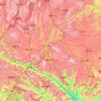
Name: Honghe Hani and Yi Autonomous Prefecture topographic map, elevation, terrain.

Location: Honghe Hani and Yi Autonomous Prefecture, Yunnan, 661300, China (22.44262 101.79847 24.76767 104.27937)

Average elevation: 1,502 m

Minimum elevation: 83 m

Maximum elevation: 3,010 m

Other topographic maps

Click on a map to view its topography, its elevation and its terrain.

Mojiaoshan

China > Yunnan > Huaping County

Average elevation: 1,280 m

Upper Yubeng

China > Yunnan > Dêqên County > Yunling

Average elevation: 3,560 m

先头梁子

China > Yunnan > Malipo County

Average elevation: 1,241 m

Yongde

China > Yunnan

Average elevation: 1,649 m

阿布吉措

China > Yunnan > Shangri-La > Xiaozhongdian

Average elevation: 4,314 m

阿卓康尼

China > Yunnan > Shangri-La > Jiantang

Average elevation: 3,305 m

Napahai Nature Reserve

China > Yunnan > Shangri-La > Jiantang > 吹宗达拉

Average elevation: 3,410 m

Pu'er

China > Yunnan > Pu'er

Average elevation: 1,416 m

Zhaotong

China > Yunnan > Zhaotong

Influenced by the low latitude and moderate elevation, Zhaotong has a temperate subtropical highland climate (Köppen Cwb), with cool, dry winters, and warm, humid summers. Temperatures frequently drop below freezing at night in winter, though the days warm up to around 10 °C (50 °F). Conversely, in summer,…

Average elevation: 2,071 m