
山巴乡 topographic map
Interactive map
Click on the map to display elevation.
About this map
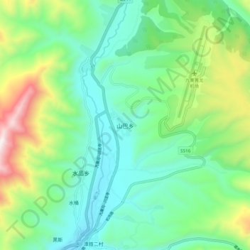
Name: 山巴乡 topographic map, elevation, terrain.
Location: 山巴乡, 松潘县, 阿坝藏族羌族自治州, 四川省, 中国 (32.79599 103.61686 32.87599 103.69686)
Average elevation: 3,330 m
Minimum elevation: 3,001 m
Maximum elevation: 4,176 m
Other topographic maps
Click on a map to view its topography, its elevation and its terrain.