
将军山村 topographic map
Interactive map
Click on the map to display elevation.
About this map
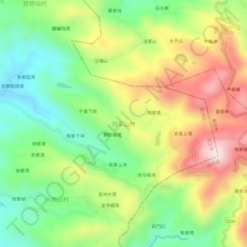
Name: 将军山村 topographic map, elevation, terrain.
Location: 将军山村, 武汉市, 湖北省, 中国 (30.86963 115.03904 30.90963 115.07904)
Average elevation: 326 m
Minimum elevation: 79 m
Maximum elevation: 657 m
Other topographic maps
Click on a map to view its topography, its elevation and its terrain.