
南江口镇 topographic map
Interactive map
Click on the map to display elevation.
About this map
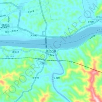
Name: 南江口镇 topographic map, elevation, terrain.
Location: 南江口镇, 郁南县, 云浮市, 广东省, 中国 (23.08751 111.77907 23.16751 111.85907)
Average elevation: 78 m
Minimum elevation: -4 m
Maximum elevation: 458 m
Other topographic maps
Click on a map to view its topography, its elevation and its terrain.