
Fort Smith topographic map
Interactive map
Click on the map to display elevation.
About this map
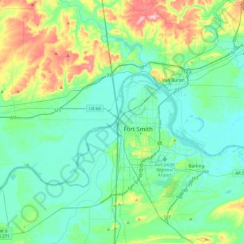
Name: Fort Smith topographic map, elevation, terrain.
Location: Fort Smith, Sebastian County, Arkansas, 72901, United States (35.22722 -94.58490 35.54722 -94.26490)
Average elevation: 163 m
Minimum elevation: 114 m
Maximum elevation: 338 m