
Saint-Firmin des Vignes topographic map
Interactive map
Click on the map to display elevation.
About this map
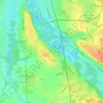
Name: Saint-Firmin des Vignes topographic map, elevation, terrain.
Average elevation: 99 m
Minimum elevation: 83 m
Maximum elevation: 120 m
Other topographic maps
Click on a map to view its topography, its elevation and its terrain.
Le Bourg
France > Centre-Val de Loire > Loiret > Amilly
Le Bourg, Amilly, Montargis, Loiret, Centre-Val de Loire, France métropolitaine, 45200, France
Average elevation: 104 m