
Parque Morelos topographic map
Interactive map
Click on the map to display elevation.
About this map
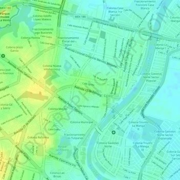
Name: Parque Morelos topographic map, elevation, terrain.
Location: Parque Morelos, Villahermosa, Centro, Tabasco, México (17.98913 -92.92247 17.98938 -92.92215)
Average elevation: 12 m
Minimum elevation: 2 m
Maximum elevation: 26 m
Other topographic maps
Click on a map to view its topography, its elevation and its terrain.
El Centro
México > Tabasco > Villahermosa
El Centro, Villahermosa, Centro, Tabasco, México
Average elevation: 12 m
Parque Indeco
México > Tabasco > Villahermosa
Parque Indeco, Villahermosa, Centro, Tabasco, México
Average elevation: 7 m
Parque Principal Tierra Colorada
México > Tabasco > Villahermosa
Parque Principal Tierra Colorada, Villahermosa, Centro, Tabasco, México
Average elevation: 9 m
Parque Laguna Encantada
México > Tabasco > Villahermosa
Parque Laguna Encantada, Villahermosa, Centro, Tabasco, México
Average elevation: 8 m