
Unterweißenbach topographic map
Interactive map
Click on the map to display elevation.
About this map
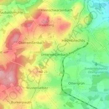
Name: Unterweißenbach topographic map, elevation, terrain.
Average elevation: 620 m
Minimum elevation: 547 m
Maximum elevation: 706 m
Other topographic maps
Click on a map to view its topography, its elevation and its terrain.
Baiergrün
Deutschland > Bayern > Landkreis Hof > Helmbrechts
Baiergrün, Helmbrechts, Landkreis Hof, Bayern, 95233, Deutschland
Average elevation: 609 m