
扎尕那 topographic map
Interactive map
Click on the map to display elevation.
About this map
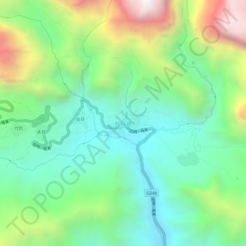
Name: 扎尕那 topographic map, elevation, terrain.
Location: 扎尕那, 益哇镇, 迭部县, 甘南藏族自治州, 甘肃省, 747499, 中国 (34.21843 103.16752 34.25843 103.20752)
Average elevation: 3,253 m
Minimum elevation: 2,814 m
Maximum elevation: 4,172 m