
Sütveren Mahallesi topographic map
Interactive map
Click on the map to display elevation.
About this map
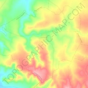
Name: Sütveren Mahallesi topographic map, elevation, terrain.
Average elevation: 663 m
Minimum elevation: 597 m
Maximum elevation: 716 m
Other topographic maps
Click on a map to view its topography, its elevation and its terrain.
Altınova Mahallesi
Altınova Mahallesi, Halfeti, Şanlıurfa, Southeastern Anatolia Region, Turkey
Average elevation: 619 m
Balaban Mahallesi
Balaban Mahallesi, Halfeti, Şanlıurfa, Southeastern Anatolia Region, Turkey
Average elevation: 655 m