
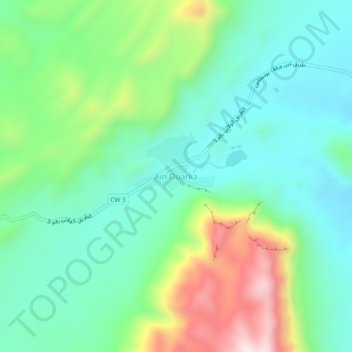
Ain Ouarka topographic map
Interactive map
Click on the map to display elevation.
About this map
Name: Ain Ouarka topographic map, elevation, terrain.
Location: Ain Ouarka, Assela, daïra Assela, Naâma, Algérie (32.71208 -0.17689 32.75208 -0.13689)
Average elevation: 1,170 m
Minimum elevation: 995 m
Maximum elevation: 1,589 m