
云贵乡 topographic map
Interactive map
Click on the map to display elevation.
About this map
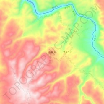
Name: 云贵乡 topographic map, elevation, terrain.
Location: 云贵乡, 威宁彝族回族苗族自治县, 毕节市, 贵州省, 中国 (27.26495 104.05422 27.34495 104.13422)
Average elevation: 1,895 m
Minimum elevation: 1,440 m
Maximum elevation: 2,243 m
Other topographic maps
Click on a map to view its topography, its elevation and its terrain.