
Mühlthal topographic map
Interactive map
Click on the map to display elevation.
About this map
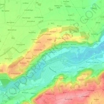
Name: Mühlthal topographic map, elevation, terrain.
Average elevation: 458 m
Minimum elevation: 403 m
Maximum elevation: 532 m
Other topographic maps
Click on a map to view its topography, its elevation and its terrain.
Hörmann
Deutschland > Bayern > Landkreis Altötting > Unterneukirchen
Hörmann, Unterneukirchen, Unterneukirchen (VGem), Landkreis Altötting, Bayern, 84508, Deutschland
Average elevation: 452 m