
Altenhausen topographic map
Interactive map
Click on the map to display elevation.
About this map
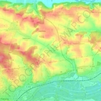
Name: Altenhausen topographic map, elevation, terrain.
Average elevation: 467 m
Minimum elevation: 421 m
Maximum elevation: 509 m
Other topographic maps
Click on a map to view its topography, its elevation and its terrain.
Amperleite
Deutschland > Bayern > Landkreis Freising > Freising > Erlau
Amperleite, Erlau, Freising, Landkreis Freising, Bayern, 85406, Deutschland
Average elevation: 460 m
Xaverienthal
Deutschland > Bayern > Landkreis Freising > Freising > Altenhausen
Xaverienthal, Altenhausen, Freising, Landkreis Freising, Bayern, 85356, Deutschland
Average elevation: 469 m
Attaching
Deutschland > Bayern > Landkreis Freising > Freising
Attaching, Freising, Landkreis Freising, Bayern, 85356, Deutschland
Average elevation: 443 m