
Kodla topographic map
Interactive map
Click on the map to display elevation.
About this map
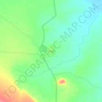
Name: Kodla topographic map, elevation, terrain.
Location: Kodla, Sedam taluku, Kalaburagi District, Karnataka, India (17.01958 77.23647 17.05958 77.27647)
Average elevation: 472 m
Minimum elevation: 446 m
Maximum elevation: 520 m
Other topographic maps
Click on a map to view its topography, its elevation and its terrain.
Kurakunta
India > Karnataka > Sedam taluku
Kurakunta, Sedam taluku, Kalaburagi District, Karnataka, India
Average elevation: 421 m
Malakheda
India > Karnataka > Sedam taluku
Malakheda, Sedam taluku, Kalaburagi District, Karnataka, 585317, India
Average elevation: 406 m
Sedam
India > Karnataka > Sedam taluku
Sedam, Sedam taluku, Kalaburagi District, Karnataka, 585222, India
Average elevation: 423 m