
Tschetschenien topographic map
Interactive map
Click on the map to display elevation.
About this map
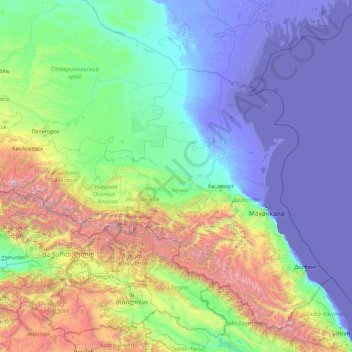
Name: Tschetschenien topographic map, elevation, terrain.
Location: Tschetschenien, Föderationskreis Nordkaukasus, Russland (40.83761 43.13850 45.95761 48.25850)
Average elevation: 643 m
Minimum elevation: -32 m
Maximum elevation: 5,329 m
Other topographic maps
Click on a map to view its topography, its elevation and its terrain.
Grosny
Russland > Tschetschenien > Stadtkreis Grosny
Grosny, Stadtkreis Grosny, Tschetschenien, Föderationskreis Nordkaukasus, Russland
Average elevation: 184 m