
Hickory Hill topographic map
Interactive map
Click on the map to display elevation.
About this map
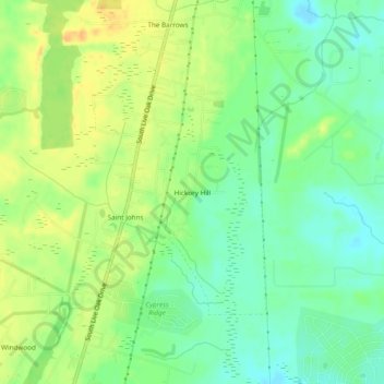
Name: Hickory Hill topographic map, elevation, terrain.
Location: Hickory Hill, Berkeley County, South Carolina, United States (33.10323 -80.08064 33.14323 -80.04064)
Average elevation: 18 m
Minimum elevation: 3 m
Maximum elevation: 35 m
Other topographic maps
Click on a map to view its topography, its elevation and its terrain.
Hound Run
United States > South Carolina > Berkeley County > Goose Creek
Hound Run, Goose Creek, Berkeley County, South Carolina, 29445, United States
Average elevation: 10 m
Dominion Hills
United States > South Carolina > Berkeley County > Hanahan
Dominion Hills, Hanahan, Berkeley County, South Carolina, 29410, United States
Average elevation: 6 m
Berkeley Hills
United States > South Carolina > Berkeley County > Hanahan
Berkeley Hills, Hanahan, Berkeley County, South Carolina, 29410, United States
Average elevation: 6 m