
Thank you for supporting this site ❤️
Make a donation
Make a donation
Nimo topographic map
Click on the map to display elevation.
Thank you for supporting this site ❤️
Make a donation
Make a donation
About this map
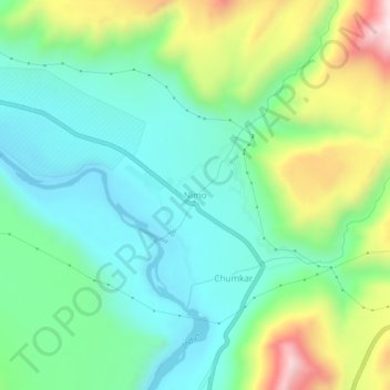
Name: Nimo topographic map, elevation, terrain.
Location: Nimo, Leh Tehsil, Leh District, Ladakh, India (34.17632 77.31551 34.21632 77.35551)
Average elevation: 3,282 m
Minimum elevation: 3,089 m
Maximum elevation: 3,731 m
Thank you for supporting this site ❤️
Make a donation
Make a donation
Other topographic maps
Click on a map to view its topography, its elevation and its terrain.