
Rivière Pentecôte topographic map
Interactive map
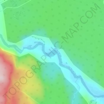
Click on the map to display elevation.
About this map
Name: Rivière Pentecôte topographic map, elevation, terrain.
Average elevation: 120 m
Minimum elevation: 11 m
Maximum elevation: 362 m
Other topographic maps
Click on a map to view its topography, its elevation and its terrain.
Lac Donaldson
Canada > Québec > Sept-Rivières > Port-Cartier
Lac Donaldson, Port-Cartier, Sept-Rivières, Côte-Nord, Québec, Canada
Average elevation: 296 m
Lac Caro
Canada > Québec > Sept-Rivières > Port-Cartier
Lac Caro, Port-Cartier, Sept-Rivières, Côte-Nord, Québec, Canada
Average elevation: 276 m