
Thank you for supporting this site ❤️
Make a donation
Make a donation
Lavaca topographic map
Click on the map to display elevation.
Thank you for supporting this site ❤️
Make a donation
Make a donation
About this map
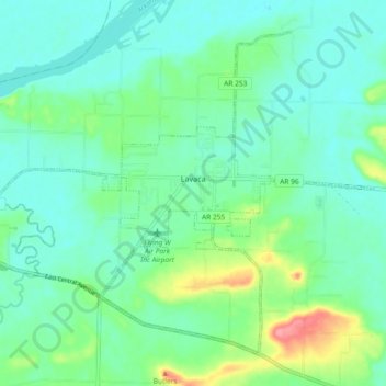
Name: Lavaca topographic map, elevation, terrain.
Location: Lavaca, Sebastian County, Arkansas, 72941, United States (35.30176 -94.22696 35.36495 -94.13476)
Average elevation: 134 m
Minimum elevation: 112 m
Maximum elevation: 201 m
Thank you for supporting this site ❤️
Make a donation
Make a donation
Other topographic maps
Click on a map to view its topography, its elevation and its terrain.