
复兴镇 topographic map
Interactive map
Click on the map to display elevation.
About this map
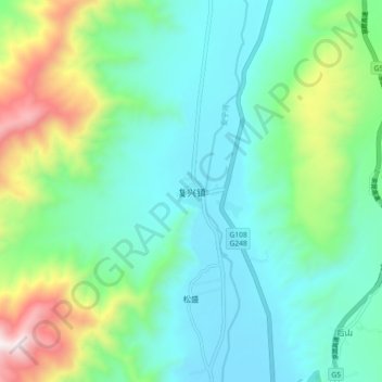
Name: 复兴镇 topographic map, elevation, terrain.
Location: 复兴镇, 冕宁县, 凉山彝族自治州, 四川省, 615600, 中国 (28.39052 102.12820 28.47052 102.20820)
Average elevation: 1,966 m
Minimum elevation: 1,664 m
Maximum elevation: 2,885 m
Other topographic maps
Click on a map to view its topography, its elevation and its terrain.