
Queenswood topographic map
Interactive map
Click on the map to display elevation.
About this map
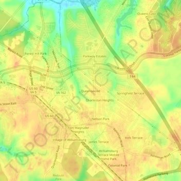
Name: Queenswood topographic map, elevation, terrain.
Location: Queenswood, York County, Virginia, 23185, United States (37.25333 -76.69333 37.29333 -76.65333)
Average elevation: 24 m
Minimum elevation: -2 m
Maximum elevation: 34 m
Other topographic maps
Click on a map to view its topography, its elevation and its terrain.
Yorktown
United States > Virginia > York County
Yorktown, York County, Virginia, United States
Average elevation: 10 m
Yorktown
United States > Virginia > York County
Yorktown, York County, Virginia, 23690, United States
Average elevation: 8 m
Tabb
United States > Virginia > York County > Tabb
Tabb, York County, Virginia, 23693, United States
Average elevation: 10 m
Seaford
United States > Virginia > York County
Seaford, York County, Virginia, 23696, United States
Average elevation: 3 m