Geolocate

Jordan Valley topographic map

Interactive map

Click on the map to display elevation.

About this map

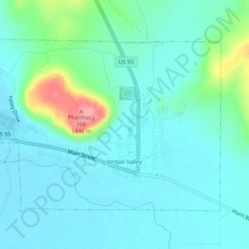
Name: Jordan Valley topographic map, elevation, terrain.

Location: Jordan Valley, Malheur County, Oregon, 97910, United States (42.96985 -117.07559 42.98855 -117.04082)

Average elevation: 1,354 m

Minimum elevation: 1,331 m

Maximum elevation: 1,453 m

Other topographic maps

Click on a map to view its topography, its elevation and its terrain.

Owyhee River

United States > Oregon > Malheur County

Owyhee River, Malheur County, Oregon, United States

Average elevation: 670 m

Beulah

United States > Oregon > Malheur County

Beulah, Malheur County, Oregon, United States

Average elevation: 1,121 m

Snake River

United States > Oregon > Malheur County > Nyssa

Snake River, Nyssa, Malheur County, Oregon, United States

Average elevation: 669 m

Cairo

United States > Oregon > Malheur County

Cairo, Malheur County, Oregon, United States

Average elevation: 669 m

Vale

United States > Oregon > Malheur County

Vale, Malheur County, Oregon, United States

Average elevation: 710 m

Harper

United States > Oregon > Malheur County

Harper, Malheur County, Oregon, 97906, United States

Average elevation: 781 m

Nyssa

United States > Oregon > Malheur County

Nyssa, Malheur County, Oregon, 97913, United States

Average elevation: 667 m

Rome

United States > Oregon > Malheur County

Rome, Malheur County, Oregon, United States

Average elevation: 1,075 m

Ontario

United States > Oregon > Malheur County

Ontario, Malheur County, Oregon, 97914, United States

Average elevation: 660 m