
Thank you for supporting this site ❤️
Make a donation
Make a donation
Glencoe topographic map
Click on the map to display elevation.
Thank you for supporting this site ❤️
Make a donation
Make a donation
About this map
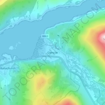
Name: Glencoe topographic map, elevation, terrain.
Location: Glencoe, Highland, Scotland, PH49 4HS, United Kingdom (56.66276 -5.12146 56.70276 -5.08146)
Average elevation: 114 m
Minimum elevation: -1 m
Maximum elevation: 682 m
Thank you for supporting this site ❤️
Make a donation
Make a donation
Other topographic maps
Click on a map to view its topography, its elevation and its terrain.