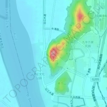
Geolocate

九华山 topographic map

Interactive map

Click on the map to display elevation.

About this map

Name: 九华山 topographic map, elevation, terrain.

Location: 九华山, 马鞍山市, 安徽省, 中国 (31.66989 118.45135 31.66999 118.45145)

Average elevation: 18 m

Minimum elevation: 1 m

Maximum elevation: 140 m

Other topographic maps

Click on a map to view its topography, its elevation and its terrain.

含山县

中国 > 安徽省 > 马鞍山市

含山县, 马鞍山市, 安徽省, 238100, 中国

Average elevation: 40 m

当涂县

中国 > 安徽省 > 马鞍山市

当涂县, 马鞍山市, 安徽省, 243100, 中国

Average elevation: 18 m

清溪河

中国 > 安徽省 > 马鞍山市 > 清溪镇

清溪河, 清溪镇, 马鞍山市, 含山县, 安徽省, 中国

Average elevation: 67 m

后河

中国 > 安徽省 > 马鞍山市 > 运漕镇

后河, 运漕镇, 马鞍山市, 含山县, 安徽省, 238141, 中国

Average elevation: 18 m

大谷家

中国 > 安徽省 > 马鞍山市 > 清溪镇 > 大谷家

大谷家, 清溪镇, 马鞍山市, 含山县, 安徽省, 中国

Average elevation: 37 m

庙山

中国 > 安徽省 > 马鞍山市 > 昭关镇

庙山, 昭关镇, 马鞍山市, 含山县, 安徽省, 中国

Average elevation: 76 m