
Brensbach topographic map
Interactive map
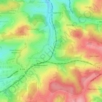
Click on the map to display elevation.
About this map
Name: Brensbach topographic map, elevation, terrain.
Average elevation: 332 m
Minimum elevation: 267 m
Maximum elevation: 396 m
Other topographic maps
Click on a map to view its topography, its elevation and its terrain.
Propach
Deutschland > Nordrhein-Westfalen > Waldbröl > Geilenkausen (Oberdorf) > Propach
Propach, Geilenkausen (Oberdorf), Waldbröl, Oberbergischer Kreis, Nordrhein-Westfalen, Deutschland
Average elevation: 260 m
Wilhelmstal
Deutschland > Nordrhein-Westfalen > Waldbröl > Wilhelmstal
Wilhelmstal, Waldbröl, Oberbergischer Kreis, Nordrhein-Westfalen, 51545, Deutschland
Average elevation: 311 m