
Sam Pui Chau topographic map
Interactive map
Click on the map to display elevation.
About this map
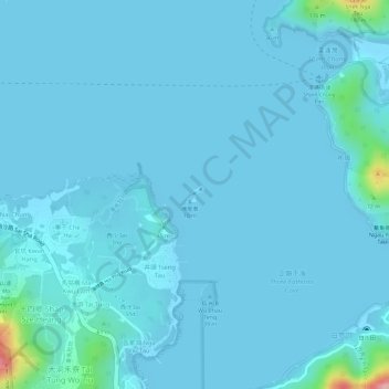
Name: Sam Pui Chau topographic map, elevation, terrain.
Location: Sam Pui Chau, Tseng Tau, Tai Po District, Hong Kong, PRC (22.43204 114.27136 22.43333 114.27276)
Average elevation: 11 m
Minimum elevation: -1 m
Maximum elevation: 169 m