
Thank you for supporting this site ❤️
Make a donation
Make a donation
Parque Jorge Cevallos Calero topographic map
Click on the map to display elevation.
Thank you for supporting this site ❤️
Make a donation
Make a donation
About this map
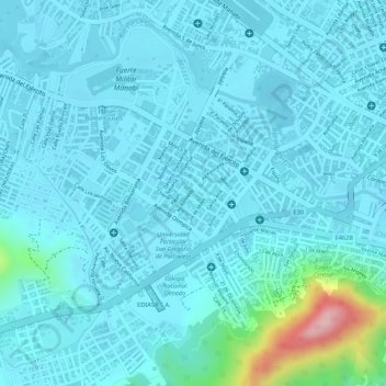
Name: Parque Jorge Cevallos Calero topographic map, elevation, terrain.
Location: Parque Jorge Cevallos Calero, Portoviejo, Manabí, Ecuador (-1.06045 -80.46958 -1.05962 -80.46889)
Average elevation: 52 m
Minimum elevation: 28 m
Maximum elevation: 224 m
Thank you for supporting this site ❤️
Make a donation
Make a donation
Other topographic maps
Click on a map to view its topography, its elevation and its terrain.